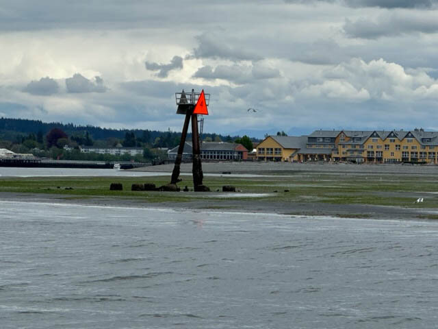
There is a saying: “From the helm, water that is 600 feet deep looks no different than water that is 6 inches deep.” Approaching the marina entrances in our picturesque Semiahmoo Bay, shallow water lurks in areas you might not expect. This treacherous area is indeed marked, but it happens to be marked in a way that, ironically, may lure a boater toward having a problem rather than warn them away. The red marker out in the water on the pilings at the end of the Semiahmoo Spit is often confused for a channel marker. It’s not. It’s a land marker.
If you are “returning” to a harbor from open water, the rule is to keep red channel markers to the right side of your vessel: Red, right, returning. Most boaters are familiar with this rule. If you follow this rule and approach any properly marked harbor keeping the red floating buoys (channel markers) always to your right, and green floating buoys to your left – you can be confident that there is enough water to safely navigate any recreational vessel. But again, the red marker at the end of Semiahmoo Spit is not a channel marker, it’s a land marker and it’s some distance away from the actual safe navigation channel. History tells us why.
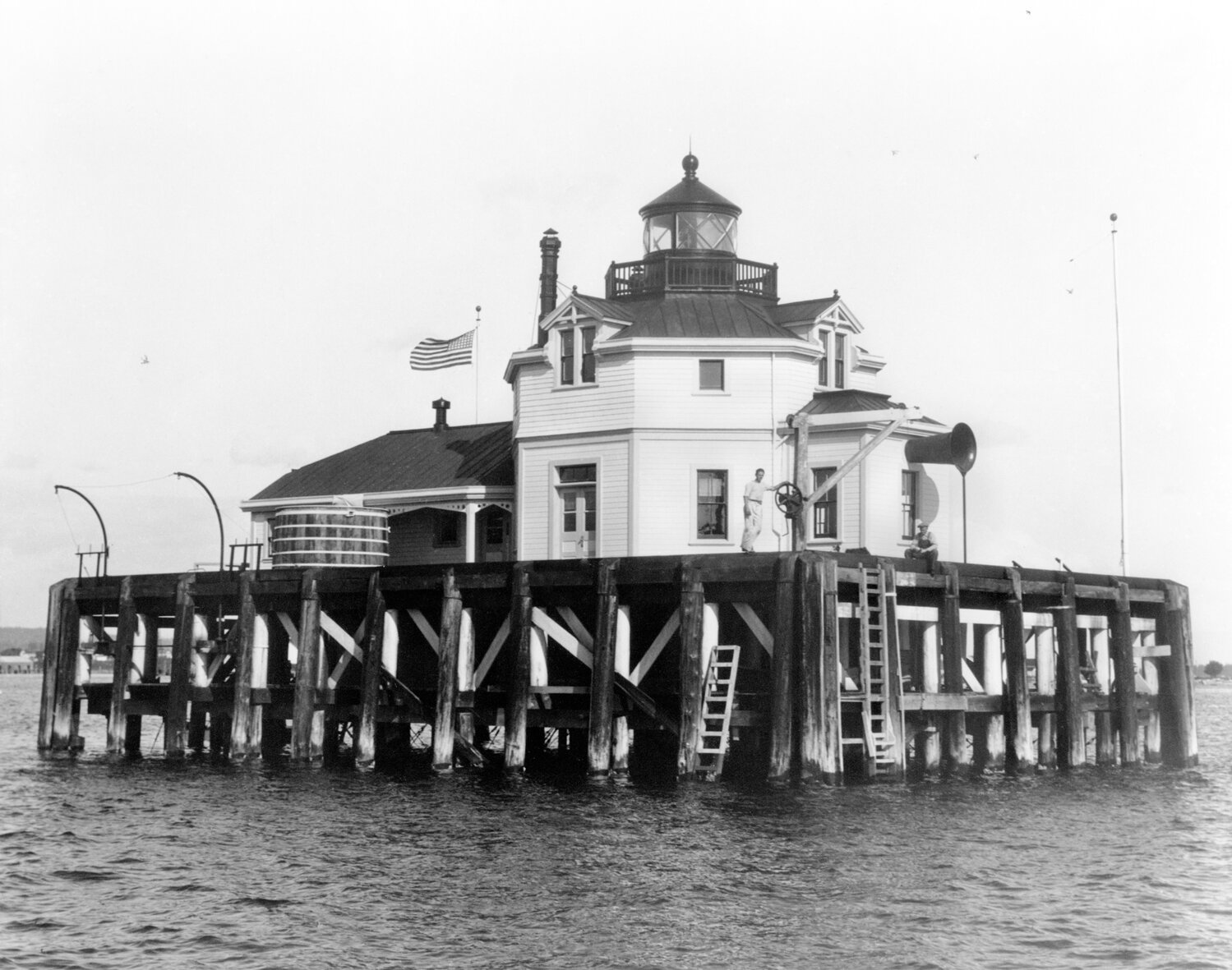
At one time, the Semiahmoo Bay and Drayton Harbor area was a bustling commercial port. In 1882, what was to eventually become the world’s largest salmon cannery began operations at the end of the Semiahmoo Spit. In addition to the cannery, there were several sawmills in operation inside Drayton Harbor. With this level of commercial traffic in and out, concerned citizens lobbied for, and eventually received, a lighthouse toward the end of the Semiahmoo Spit. These significant lighthouse structures stood watch there from 1905-1944. Having lighthouse buildings over that area of water made it fairly obvious that this area was not the navigable channel.
Fast forward to today. What replaced the lighthouse, in the same location, is technically called a “light,” or a “day beacon.” Because this day beacon is red, it is understandably easy to confuse it with a channel marker. It is not. A land marker (beacon) is red and triangular in shape, whereas channel markers are large red or green floating buoys. Being on the (seaward) side of our red Semiahmoo light/day beacon does not guarantee that you are in deep enough water. It may look like it could be 600 feet deep, but it may very well be six inches deep anywhere near it. The giveaway is that the Semiahmoo day beacon is built on pilings; pilings that are in the ground not far under the water’s surface. Alas, at times there is no water there at all.
At low tide levels, there is exposed land well on the seaward side of the Semiahmoo beacon. The navigable channel is actually many yards farther seaward of the beacon. One should always steer well-clear of the beacon. The proper course when headed seaward is to steer toward the green channel marker, keeping it on your right side, and from there navigate to the red floating nun buoy farther out in the bay, keeping it on your left. And reverse this course when returning to the harbor. Always keep in mind that channel markers are floating, they aren’t on
pilings.
Our Semiahmoo Spit shoreline is beautiful and interesting, but don’t let the beacon beckon you too close. Navigate only by floating buoys and you’ll avoid having lunch on the beach, in your boat, tilted sideways, while you wait for the tide to come in.
Captain Randall Parten owns and operates the Dream Boat Company in Blaine and will provide marine towing services for those boaters who miss this article.


Comments
No comments on this item Please log in to comment by clicking here