Although hard to imagine, about 16,000 years ago a glacial ice sheet one-mile thick covered the Blaine and Birch Bay area. This ice was part of an extension of Cordilleran Ice sheet that covered present-day southern Alaska and parts of western Canada. The extension is called the Puget lobe, and at the peak of its advancement it covered all of Puget Sound and extended as far south as the Olympia and Centralia area.
When the ice sheet melted and receded about 11,500 years ago, glacial processes had dramatically altered the land surface around Blaine and elsewhere. Many of the features you see when driving around the region are a direct result of these processes of scouring, deposition and erosion.
For example, if you drive east along Grandview Road between the Cherry Point Refinery and Interstate 5, you climb up and down a large hill that affords great views of surrounding areas. This raised landscape feature is a glacial moraine consisting of the Grandview Moraine and the Holman Hill Moraine. Such moraines are formed when the end of a glacier remains in one place for a relatively long time. Gravel and rock carried in the glacier is deposited at the glacier’s end, forming a moraine.
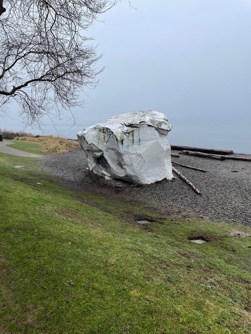
Even the large white rock sitting along the shore of the city of White Rock, just north of Blaine, has a glacial history. It was plucked by the moving ice from some other location and deposited at its current position thousands of years ago.
Jonathan Hall resides in Birch Bay. He is a retired biologist who has worked in many regions of the U.S. while employed with the New York state, the U.S. Fish and Wildlife Service, several environmental consulting firms, and the Tulalip Tribes of Washington.


Comments
No comments on this item Please log in to comment by clicking here